Annapurna Circuit
One of the world's greatest long-distance treks — a complete circumnavigation of the Annapurna massif crossing the 5,416m Thorong La Pass.
Distance
160 km
Duration
15 days
Elevation Gain
8,000m
Max Elevation
5,416m
Min Elevation
820m
Highest Point
Thorong La Pass (5,416m)
Difficulty
Challenging
Best Season
October-November, March-April
Route Type
Loop / Circuit
Permit Required
Yes
Permit Cost
USD 40
Permit Information
ACAP permit (NPR 3,000) and TIMS card (NPR 2,000) required
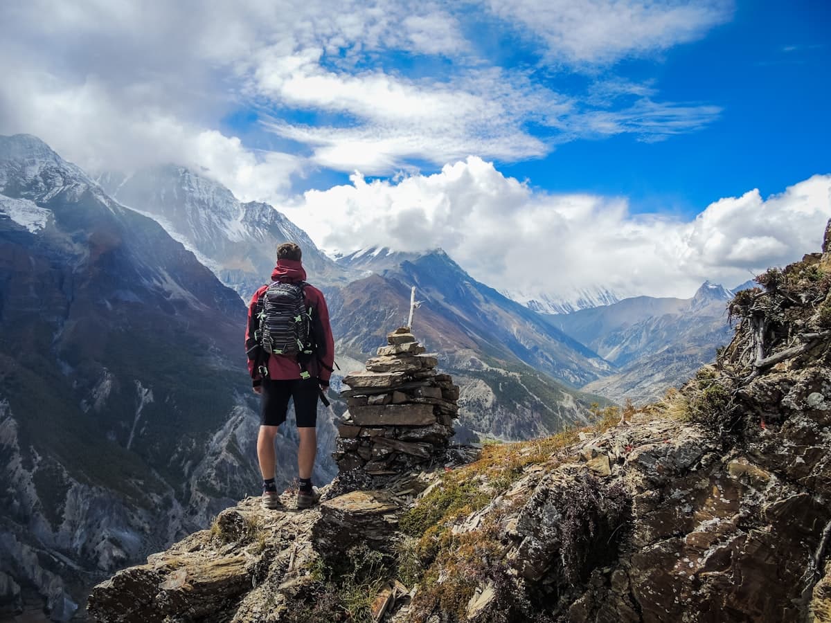
The Annapurna Circuit is widely regarded as one of the world's greatest long-distance treks — a complete circumnavigation of the Annapurna massif that traverses an astonishing range of terrain, climate, and culture. The route climbs from subtropical lowlands through temperate forests, past alpine villages, over the 5,416m Thorong La Pass, and descends through the arid Kali Gandaki valley — flanked by Dhaulagiri (8,167m) and Annapurna I (8,091m).
The eastern ascending side passes through Gurung villages and river valleys before reaching the spectacular Manang Valley, a high-altitude basin of Tibetan-influenced culture. The crossing of Thorong La is the trek's crux — demanding but non-technical. The descent to Muktinath, a temple sacred to both Hindus and Buddhists, marks the transition to the western side.
The classic circuit has been affected by road construction, and many trekkers now use jeep transport to bypass lower road sections. Despite these changes, the trek remains magnificent. Teahouse infrastructure is excellent throughout. The route is typically trekked counter-clockwise for optimal altitude gain, with at least one rest day in Manang for acclimatization.